Quick Map
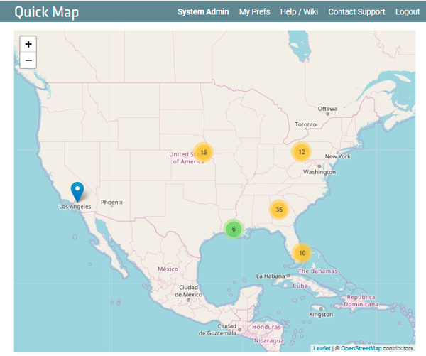
A map display of assets scanned with TrackAbout Mobile 7 is available on your TrackAbout website on the Quick Map page.
How It Works
Quick Map is only intended to be enabled for customers:
-
Using all smartphones — rugged devices don't have GPS capture
-
Having geo-location in Smartphone enabled in client configuration
-
Having fewer than 7,000 assets.
When enabled, the Quick Map page can be found in the Management Reports section. This page renders an interactive map that shows the last-known geo-location of every uniquely tracked asset in the system. Not-Scanned assets are not included.

Clustering
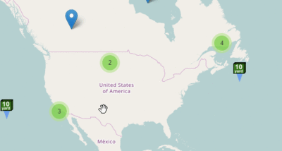
Assets close together are shown as a cluster with a quantity number. Clicking on the cluster or zooming in expands the cluster.

Links in the ToolTip
In the tooltip popup for each asset marker, we include two links:
-
A link to the Asset History page for the asset. Opens in a new tab.
-
A link out to Google Maps, which opens in a new tab. This passes a single asset's coordinates to Google Maps. From Google Maps, a user can use all the power of Google Maps to see where his dumpster might be. A user can use Street View to see landmarks, plot a course to get driving directions to go pick up a dumpster, and share the Google Map with employees, so they can go fetch the dumpster more easily.
Custom Icons
Custom Icons can be assigned by Asset Type and is especially useful when the client has just a few Asset Types. These custom icons need to be specially created and loaded in the system. Icon creation may incur professional services fees.
Customizing TrackAbout
TrackAbout is highly customizable to meet specific business needs. If you are interested in customizing TrackAbout to better meet your needs, please contact TrackAbout Support.
